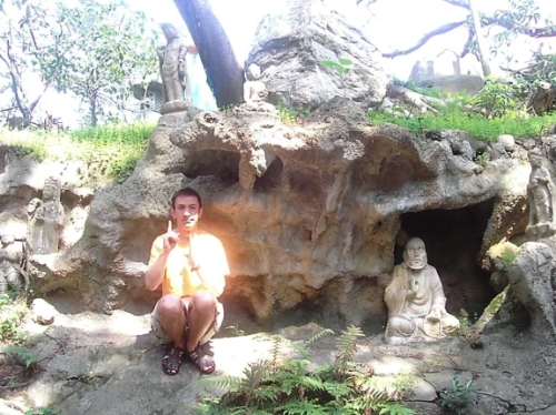
Miki d'Kolan Homepage
|
|
|
In the valley below
the village are good wells of water, which, by means of a small aqueduct, once
provided the water for ancient Kissa.
Allegedly this was one of three cities named Kissa in the Mediterranean, mentioned by
Plutarch in his "History", where he described how it was destroyed in an
earthquake. I could not confirm this mentioning, and the whole story is rather
dubious. It seems, from informations in
the church books and oral tradition, that Kolan was larger in 18th and 19th century than today.
In any case, it was a large village, with peasants and shepherds all working
for riches of Pag families, who made their fortune on salt from salt panes.
In the twenties of XX century peasants could become a legal land owners (which
they already used for generations, usually), and parcelling of the island
started. That is the "secret" of the newer stone walls, as the rule has been
accepted that every owner has to built ONE wall, the one which will stop the
sheeps from the neighbour pasture to go to his one. Most of the longer walls
seen today have been finished until the 1960s, as well as the water
reservoirs ("lokve") in some pastures. The older walls are generally of a
less regular shape.
My "theory" about the walls is more "romantic": the
way for contraception. When somebody already had 4 or more children and food
was always a problem, what a poor man could do in the early morning, when the
will came to him and his wife? Run out to the pasture and do some meter or
so of the wall!
Joking, sure, but nowadays a stone building or repair could indeed be taken as
as meditative physical activity. There is a stone walls building association
in Kolan and they actively participate in Croatian and Mediterranean events, preserving
the ancient artizanship.
History is not straightforward: Kolan in the recent past
(beginning of the 18th ct.) was not some ''idyllic'', backward place. In the
fields below Kolan was a coal-mine since Napoleon time (his armies passed
here, leaving a story about 'Mongol' warrior of French army who had a
child with local woman, and the heritage would supposedly be still visible in the
appearances of some of the descendants). A narrow-track
railway (beg. of the XX ct.) and later, instead of it, a cable-rail, was
built to the small nearby port Simuni. Even today it is possible to see some
remains of this infrastructure (see Kolan coal-mine,
railway and cable-rail). During the WWII, for a short time there was
even a small colony of captives (under local Tito's partisans) working in
the mine.
(Un)fortunately for Kolan, tourists come to Pag to enjoy the sea coast.
Therefore, people mostly built houses-and appartments for
renting-in Mandre, nearest coastal village, which is administratively part
of Kolan. Mandre was established in 1930s by the government (then Kingdom
of Yugoslavia) as a re-location of Kolan, to prevent spreading of malaria,
which severely attacked areas near the wetlands along Dalmatia. Only a few
households actually moved at that time from Kolan, and this was the start of Mandre.
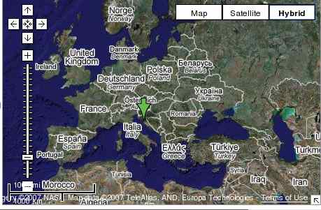
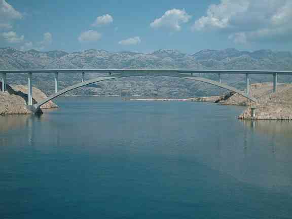
The island of Pag is the fifth biggest
in the Adriatic sea. It is streched as a 65 km long, narrow piece of stone,
with the maximum width of 5 km. It was one of the first islands where Slavic
people settled - as it is closest to the firm land, channel Fortica (under
the today's bridge) being only 100 m wide.
History of the island of Pag is long-some rests of after pre-Illyric
inhabitants were found-but their history is not wel known. It is known the
island was called Cissa or Kissa in ancient times, by the city Kissa (today
Caska), which was the first important settlement on the island. It was
allegedly ruined in an earthquake at the end of 4th ct, as already mentioned
above. After the final ruining of Kissa in XIII ct.,
another settlement, old city of Pag, became more important. It was located
where today is the "Old city" (=Stari Grad). In the XV ct. the city moved to the
better, today's position, which has better harbour and more space. Famous
Dalmatian sculptor and architect-Juraj Dalmatinac (who built Sibenik's
cathedral) was the author of the city plan-4 quarters divided by straight
lines, and some building ornaments. Today's cathedral, more ornamented copy
of the church at the Stari Grad location, is the central object in the city.
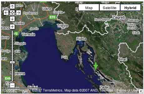
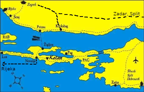
Island of Pag was always divided between Rab and Zadar - even today this
dividing line holds, as northern part of the island (with the city of
Novalja) is part of the Gospic and Senj authority, and southern (with
the city of Pag) is under Zadar authority. Kolan is close to the border
line, but went rather under Pag, as its fields and pastures were
traditionally in Pag city families possession. Since 2003, Kolan, together with
Mandre and Kolanjski Gajac, is the newest independent organisational unit on the island
(Općina Kolan).
Kolan coal-mine, railway and cable-rail
Kolan ethnographic collection
,
Kolan singing O "ribicima", ribicama procistacima, ekologija, za
Kolanjce (in Croatian) World
Wetlands Day -> Kolanjsko blato
Damir Cemeljic retro ad webpage
Gligora Cheese factory webcam, view from Kolan
Pag, the island and the city:
Pictures:
Pictures from Kolan/Pag,
Mountains
Links connected with Kolan/Pag:
Webpage on Slana Bay WWII Concentration Camp
Uvala Slana Concentration camp (WWII, 1941)
Porodično stablo Kolana/Kolan genealogical tree
Kolan genealogical tree
Virtualni Kolan/Virtual Kolan
Virtual
Kolan
To Miki's professional page:
http://web.tiara.sinica.edu.tw/~miki/
Weather in some interesting (for me) places


Whole Taiwan weather
Last updated: September 2020 by Miki. All rights reserved.
You are visitor since February 27, 2004
Kostenlose Online-Counter gibt's bei www.digits.net.